Hopefully after a few days of work, all the content from the ‘free’ WordPress sites I previously used will be consolidated here. If you find any dodgy links, please let me know!
Hopefully in the next few weeks I’ll be adding the other walks I’ve done since September 2022. I only moved house a month ago, so promises might be promises… 😁
This is the latest in a group of posts exploring the Tissington Trail. The last one ended at Biggin.
This was another early start, parking outside St. Thomas’ Church in Biggin, just before sunrise. It’s a short walk to the Tissington Trail outside the village.
The early pictures quite ‘dull’ because of the lack of sunlight, particularly in the cuttings, but they d show the different environments: some dark, damp and autumnal and some more exposed that cling on to summer. Almost.
I was quite disappointed to see someone else immediately I got onto the trail. Like a geriatric version of ‘The Terminator’ he followed me for about a mile. A lovely bloke but it was hard to get any pictures or videos without him and his dog being there.
Never mind, he’s got as much right as me (if not more) to enjoy the surroundings with his dog!
As you might already know, the Tissington Trail was a train line from Ashbourne to Buxton (the London and North Western Railway (LNWR) and it closed in 1969. There isn’t much railway paraphernalia left, apart from the bridges and an occasional tribute to the railways of yesteryear…
The walk continued, sometimes looking ahead to the trail and sometimes looking back as the sun began to rise:
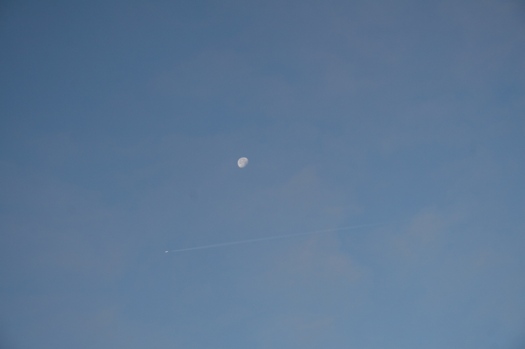
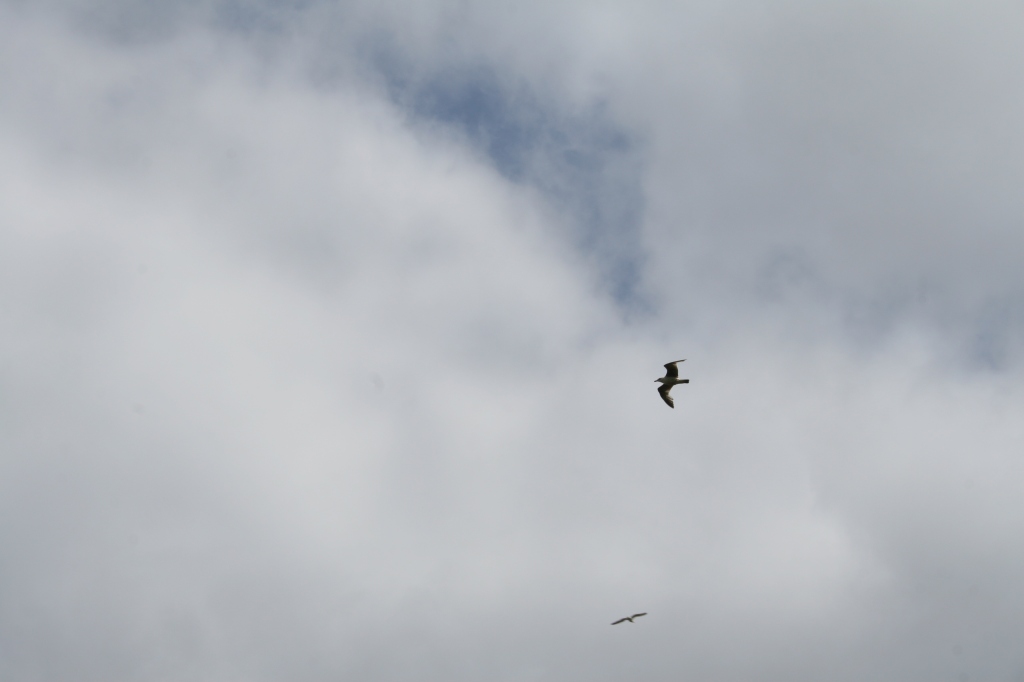
I was delighted to get a shot of an aeroplane crossing the moon. It’s not a great picture but I was so pleased to be able to get it.
Then onwards, but still looking back at the sun coming up:
Some of the cuttings don’t get much sun, particularly first thing in the morning, so they smell very autumnal: of rot and damp. Most plants here have long gone to seed and they plants await winter and a new start next Spring…
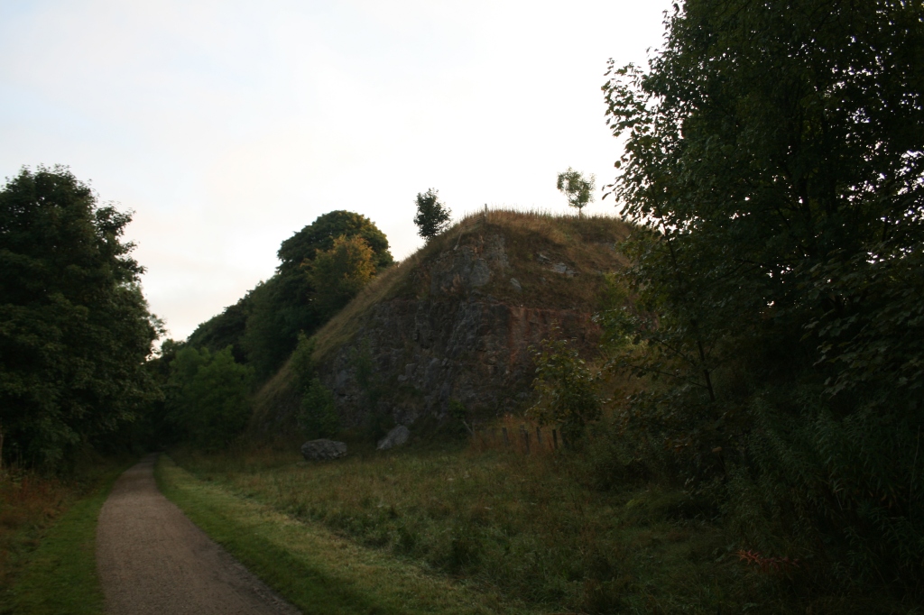
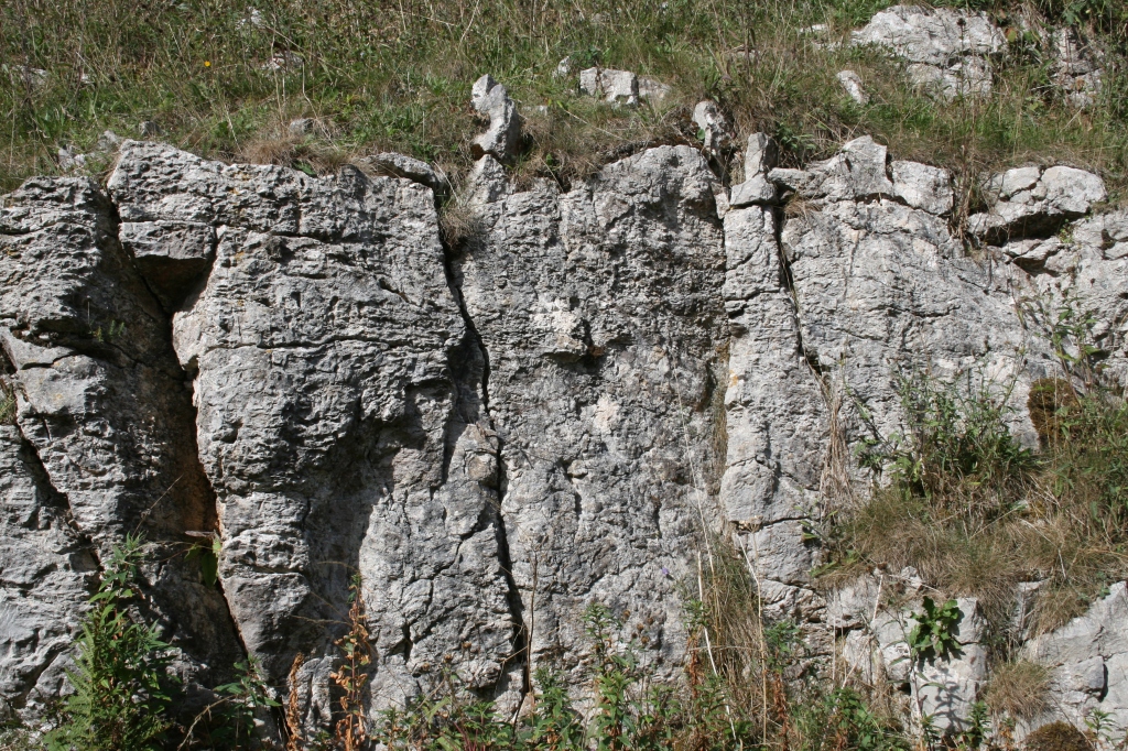
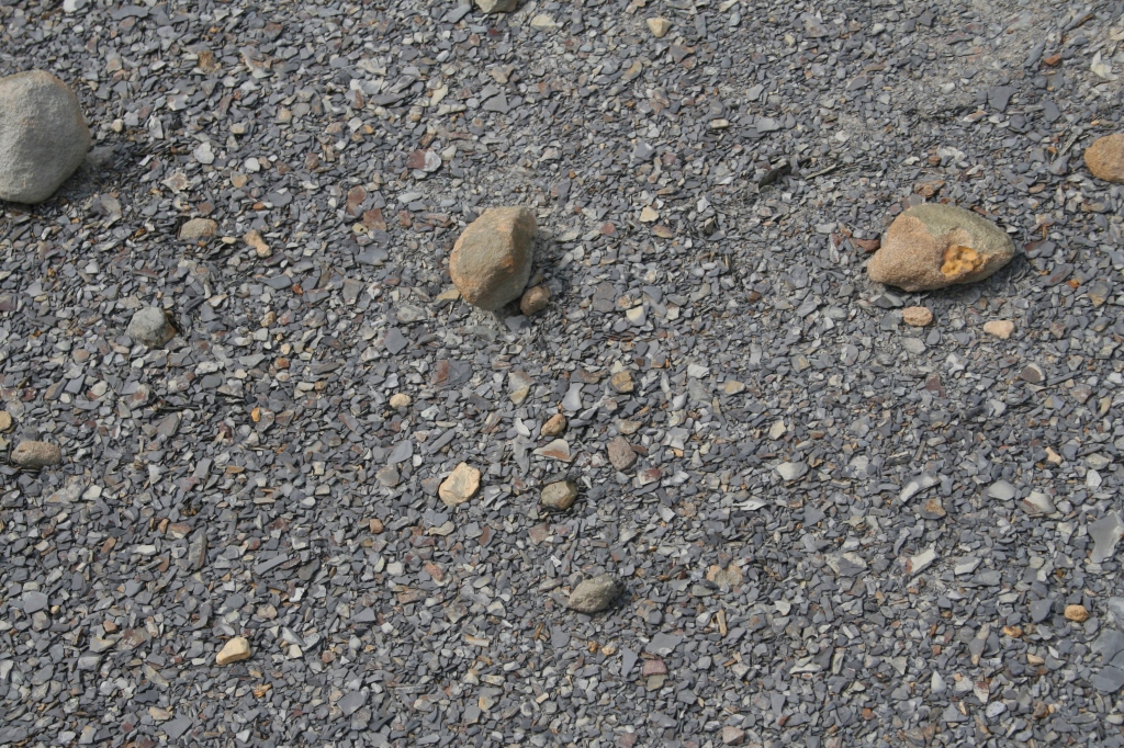
Then you’re suddenly into rocky landscape, blasted by the men who built the railway line.
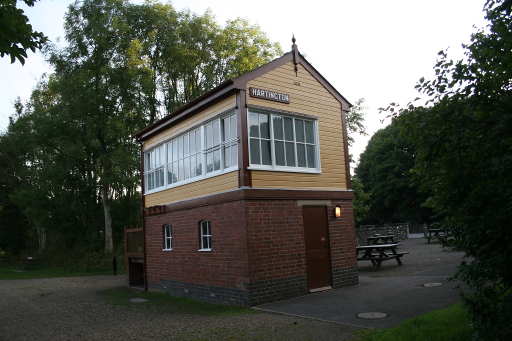
Hartington Station: somewhere to sit and have a break, or avail yourselves of the toilets. Sadly the teashop (part of the signal house) looks empty and is presumably closed down. I was gagging for a mug of tea, too…
My first genuine picture of wildlife, if you can actually see it: a deer grazing. I managed a couple of pictures but it heard the ‘click’ when I changed my camera lens and it was soon gone:
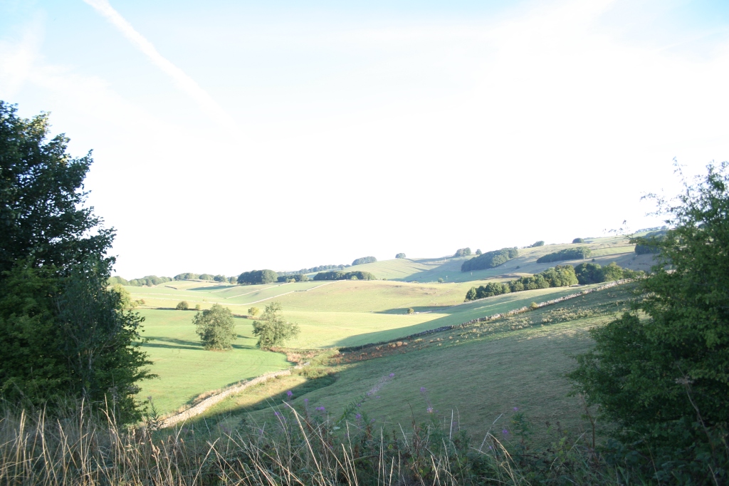
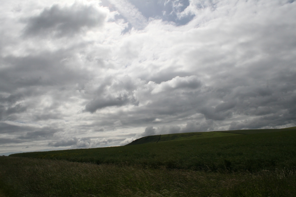
Then it’s off north, continuing on to Parsley Hay: the landscape continuous to be a mixture of of open, pastoral countryside and bleak, rocky cuttings hacked away by manual labour and explosives. Some people may be unaffected, but I found my mood changing between the bright, open and sunny sections and the darker, rocky parts of the trail.
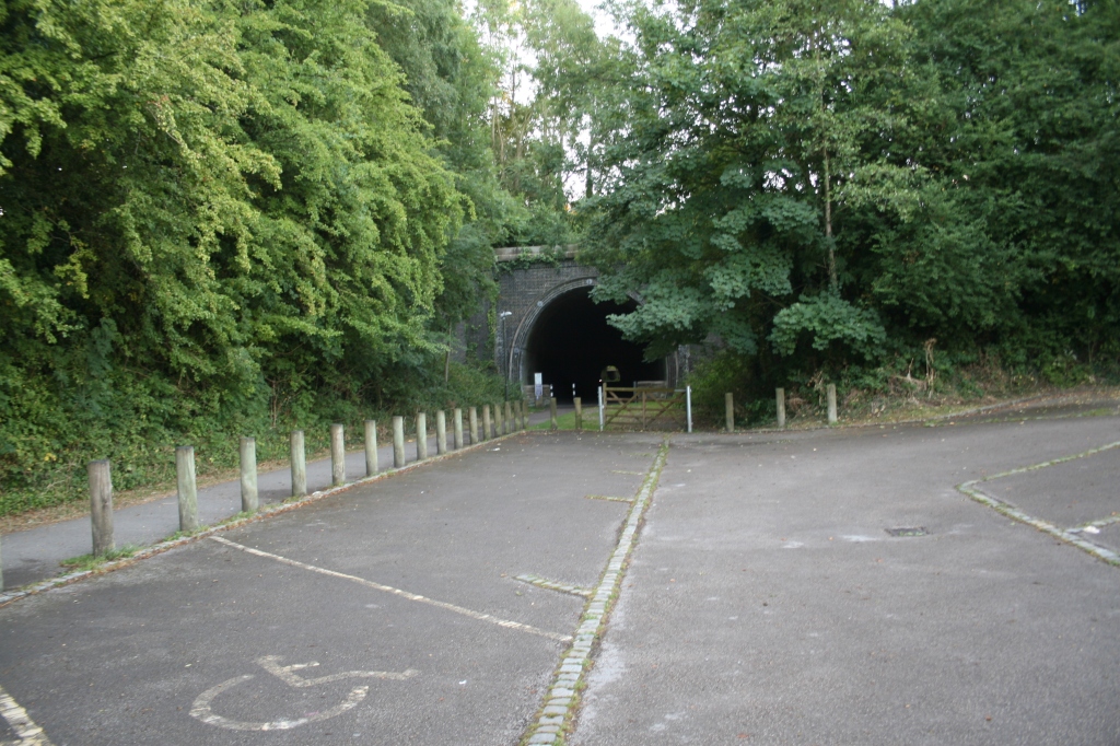
This is an impressive cutting right through the rock leading to open countryside and the former Parsley Hay station. There isn’t much left of it but you can get a tea and something to eat, or hire a bike. Bear in mind these facilities will be closed in the winter.
It’s also where the Tissington Trail meets the High Peak Trail.
I walked back via the High Peak Trail but that’s another post and another website as I’ve run out of storage space again here!
I’ve set up Up Hill and Down Dale Walks Three but it might be a while before I get to add to it….
There’s also a future walk north of Parsley Hay to be done!
You’ll notice the Croatian roundhouse, which was gifted to European Union members by Croatia when they joined the EU in 2013. Sadly, the UK should have been celebrating 50 years of membership a few days ago on the 1st of January 1st 2023, but that’s British politics and a dose of stupidity for you. 😣
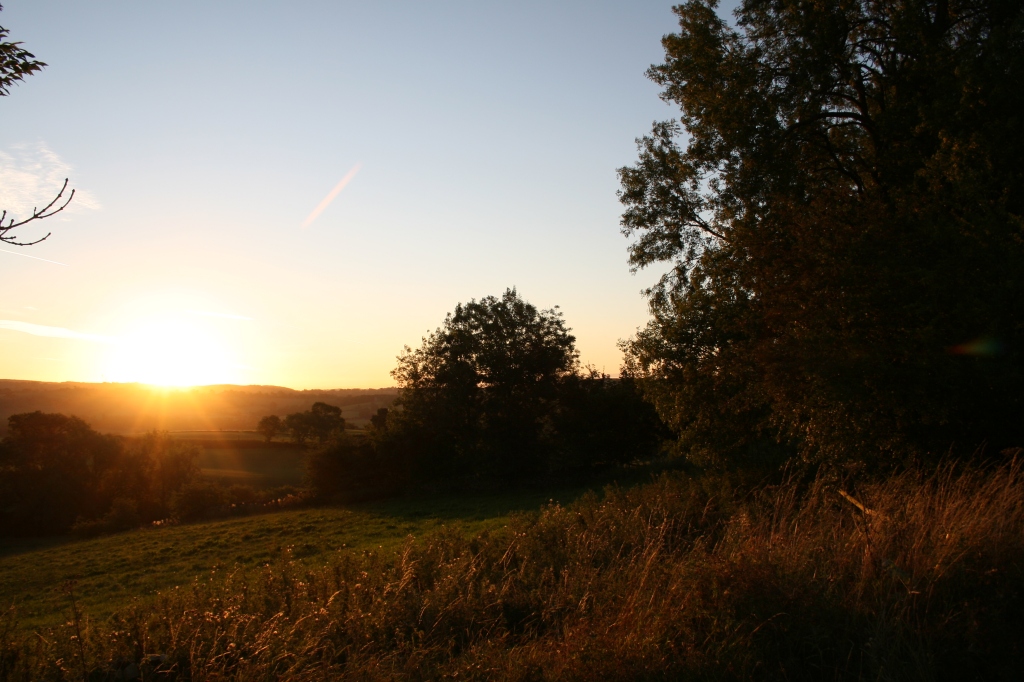
It was an early start at 6.15am from Tissington, mainly to avoid holiday crowds. It’s actually quite dark as the station is in a cutting.
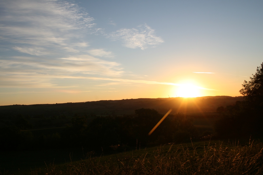
Once you get out of the cutting you get the full benefit of the morning sun. It was 10 minutes after sunrise so the landscape looked spectacular.
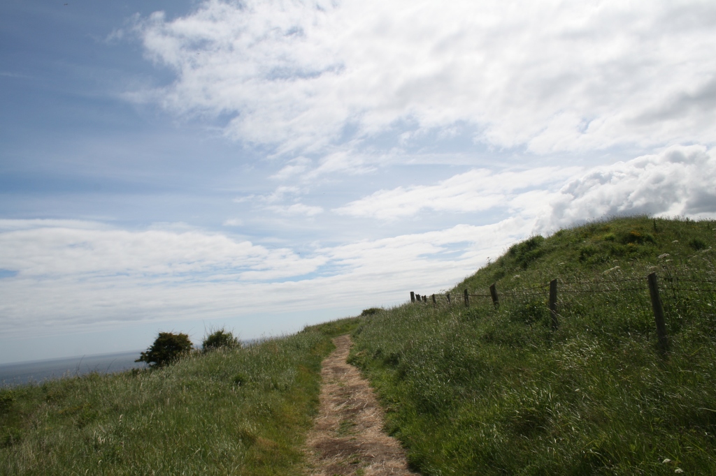
This stretch of the Tissington Trail is a mixture of cuttings and raised up areas, so in one area you get lots more trees, foliage and insects and in the other, the landscape is sparser but the views are beautiful. It can get very windy in the winter, so take care when you walk on more exposed sections of the trail.
The wind is cool and helps on a sunny day as this (luckily) was:
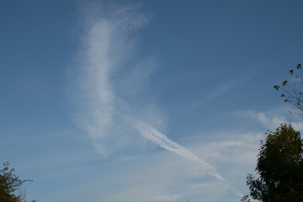
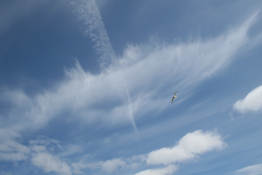
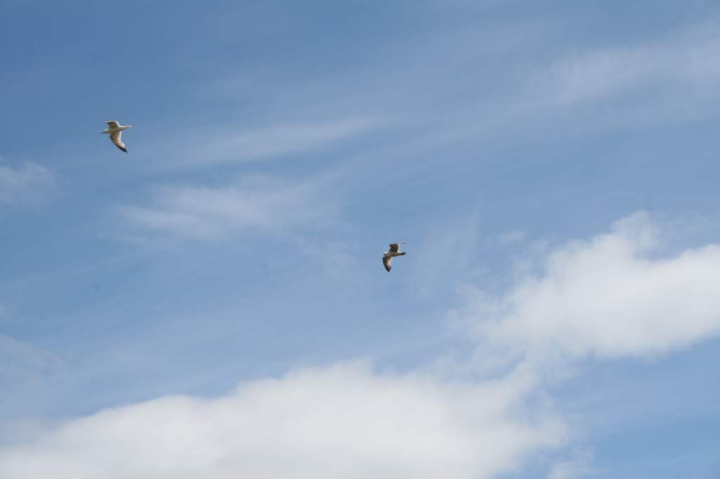
The views here are lovely, particularly if you like blue sky and cloud. There were a lot of trails from aeroplanes passing overhead…
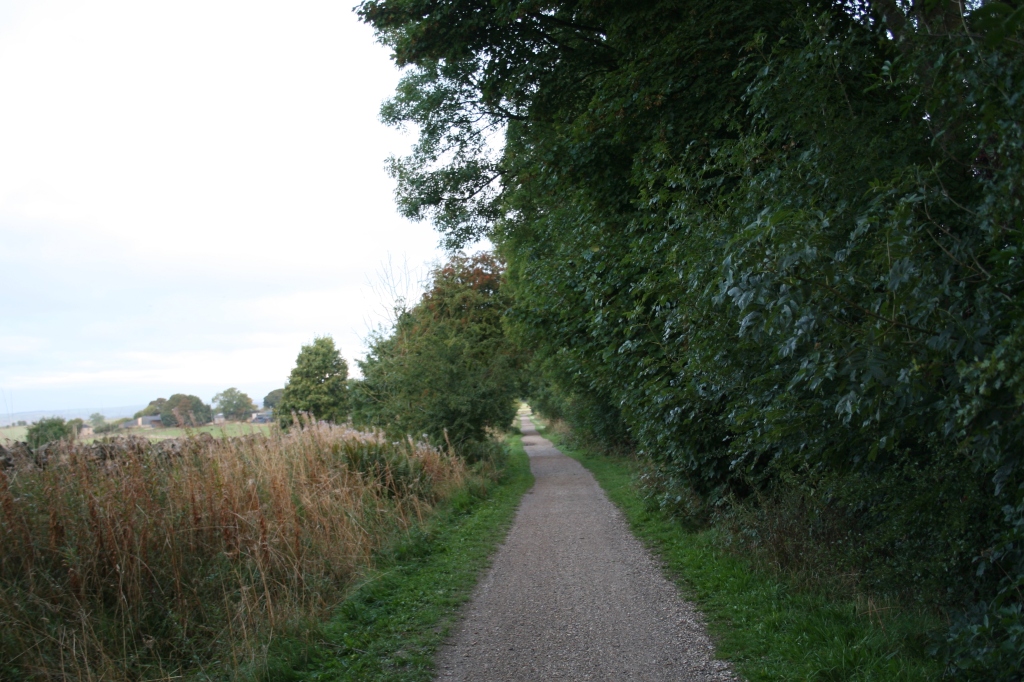
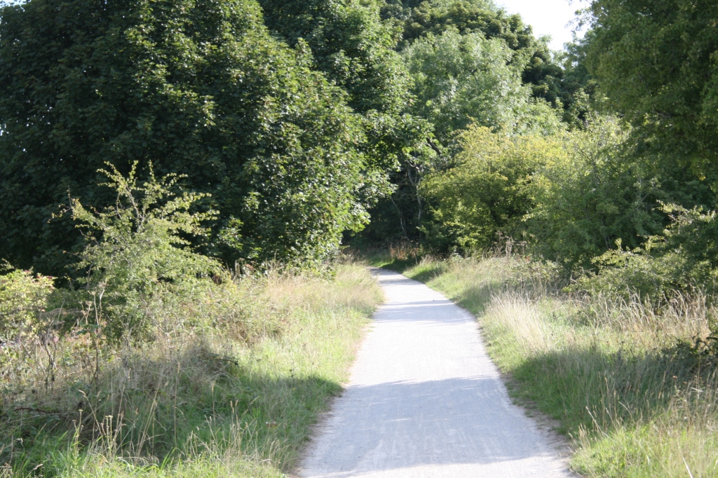
Then it’s onwards as the trail gently begins to rise, in and out of the cuttings:
This is my favourite picture of the walk:
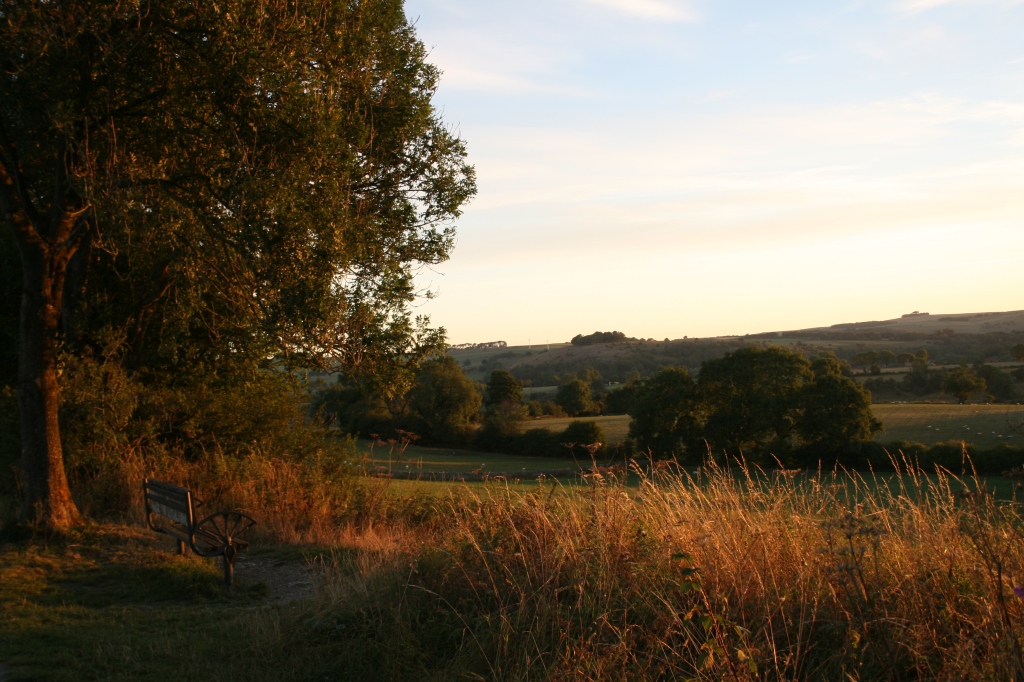
Then you arrive at Alsop. There isn’t much there apart from a shelter and several benches to stop and have a break. It’s worth having a rest as the next section does get a little more steeper and there’s nowhere to stop after Alsop (apart from one bench) until you get to Hartington, 5 miles north.
The views do get more interesting if you like landscapes…
The useful bench:
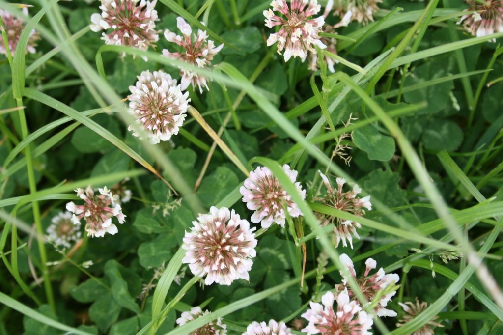
Flies can be bothersome here although they are more interested in flowers that you or I.
I left the Tissington Trail at Biggin:
Biggin itself isn’t exciting but the church of St. Thomas is worth a look. Sadly it’s locked (as churches have to be) so you can’t go inside.
The bus stop to head north to Buxton is outside the church and the bus south to Ashbourne is opposite. Buses run roughly hourly in the morning until midday(ish) and hourly from 3pm. Check the timetable before you think of using bus services around here!
I took the bus back to Tissington and hobbled back to the Tissington trail but walked through Tisington church on the way:
It’s not the most exciting of walks but it is peaceful and rural. I started early, around 6.30am, to avoid the school holiday crowds.
The sun was strong from the east as I headed north, up the Tissington Trail to Tissington and a quick wander around Tissington village and Tissington Hall. Needless to say, I wasn’t invited in for tea…
It was much busier with people on the way back, around 10.30am, so if you don’t like crowds, start early.
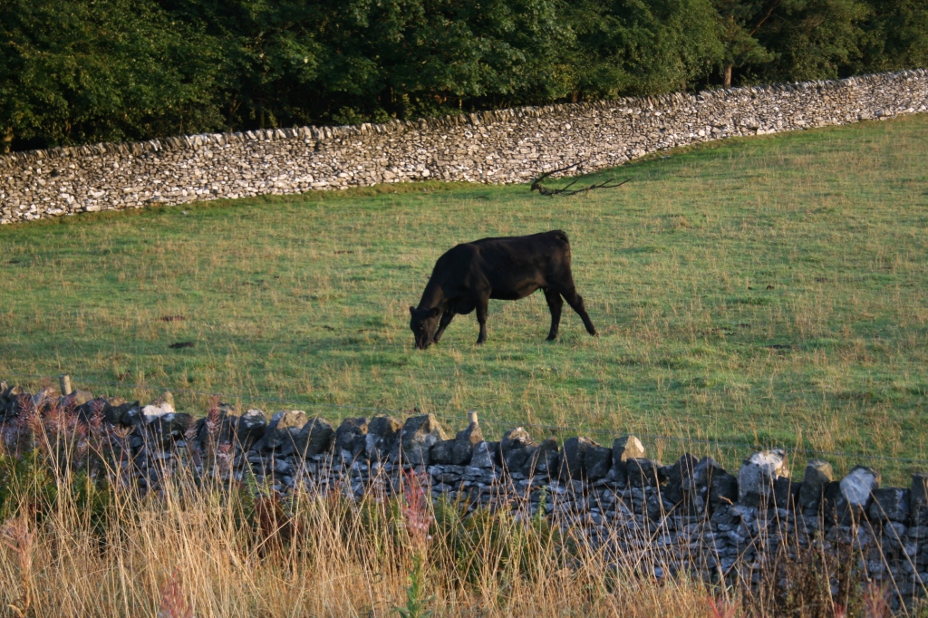
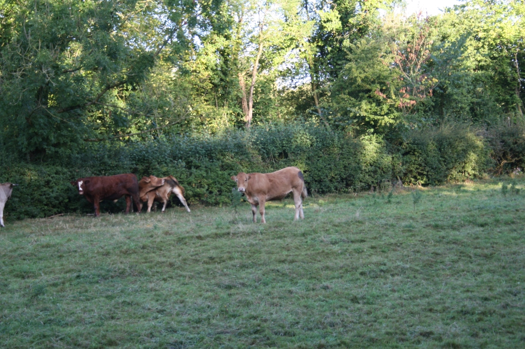
The matriarch was on guard for ‘her’ herd, while the rest of the cows got on with eating:
It was a great day for clouds:
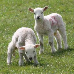
And sheep…
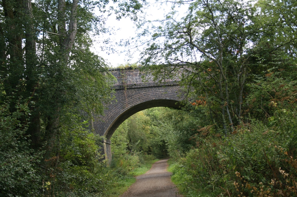
I love the bridges that cross the trail as it begins to rise up:
Dew on the grass. Despite the dry weather, there’s still plenty of moisture here as it’s shaded.
Eventually arriving at Tissington for a well-deserved sit down! There’s well-kept toilets and also an accessible toilet. The cafe opens at 10am.
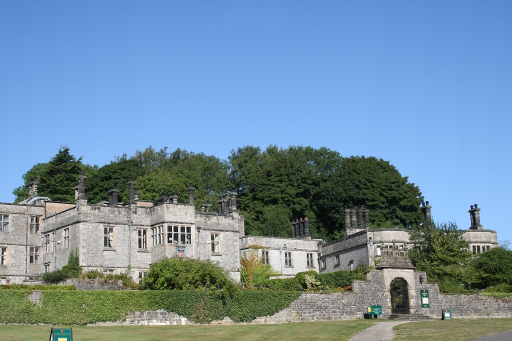
Then a quick wander around Tissington village. Most of the shops don’t open until 10am and I arrived too early. Tissington Hall is impressive, dating from 1605.
Who can resist taking pictures of budleia?
Then is was back down south to Ashbourne. It wasn’t madly busy but there were enough people about to make it less enjoyable than the outward walk.
It’s about 8 to 8.5 miles. Recommended. I plan to walk the next section of the Tissington Trail from Tissington to Alsop, where the trail rises up into the Peak District properly. There’s less trees and the views are fantastic.
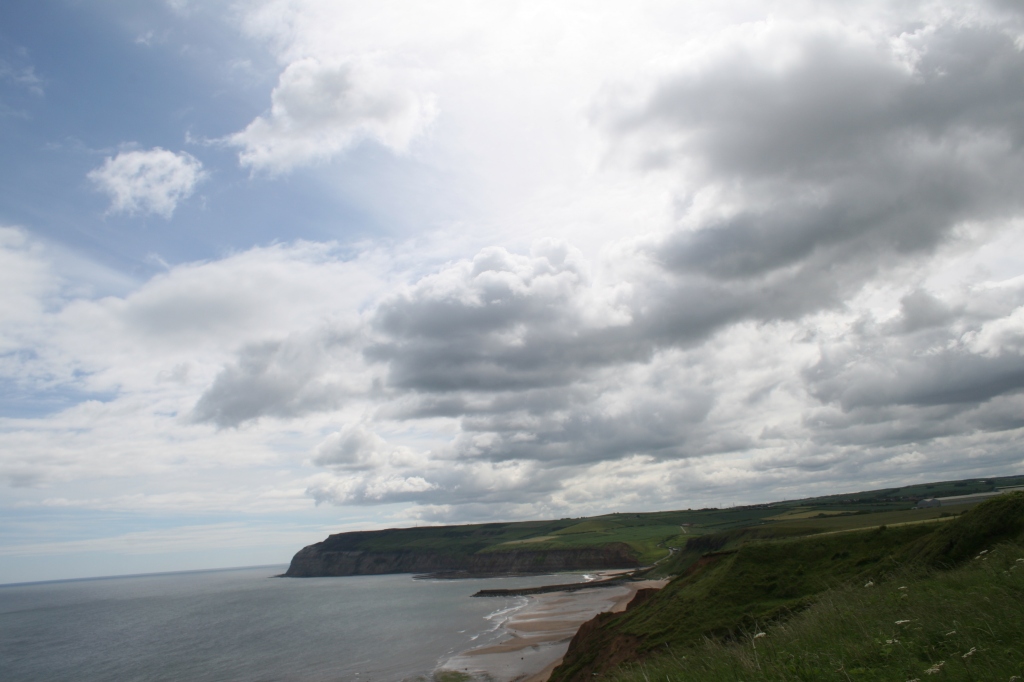
This was the next stage of a walk from Saltburn-by-the-Sea to Skinningrove – the last post.
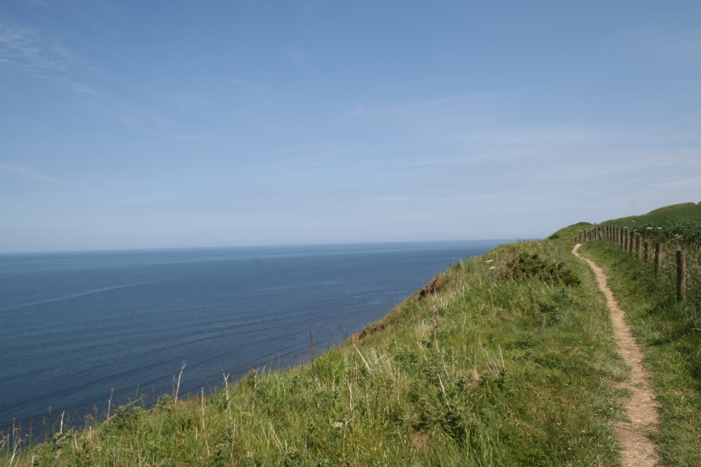
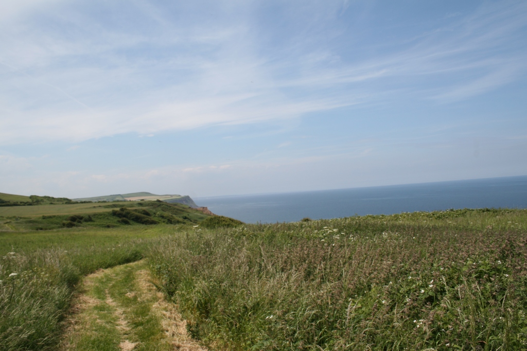
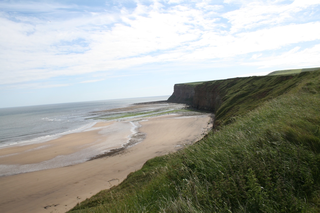
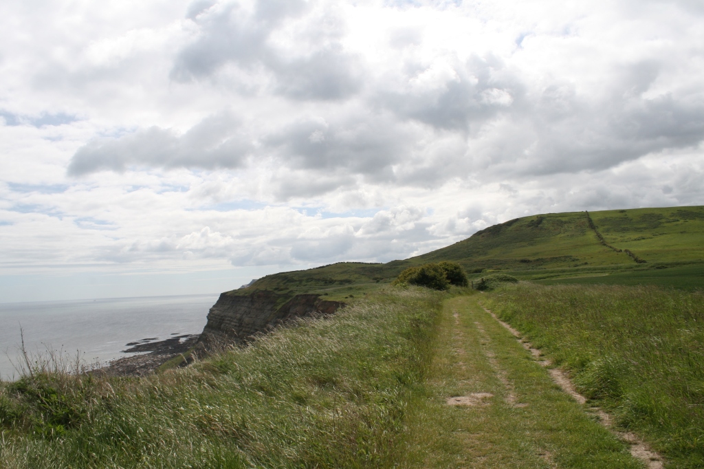
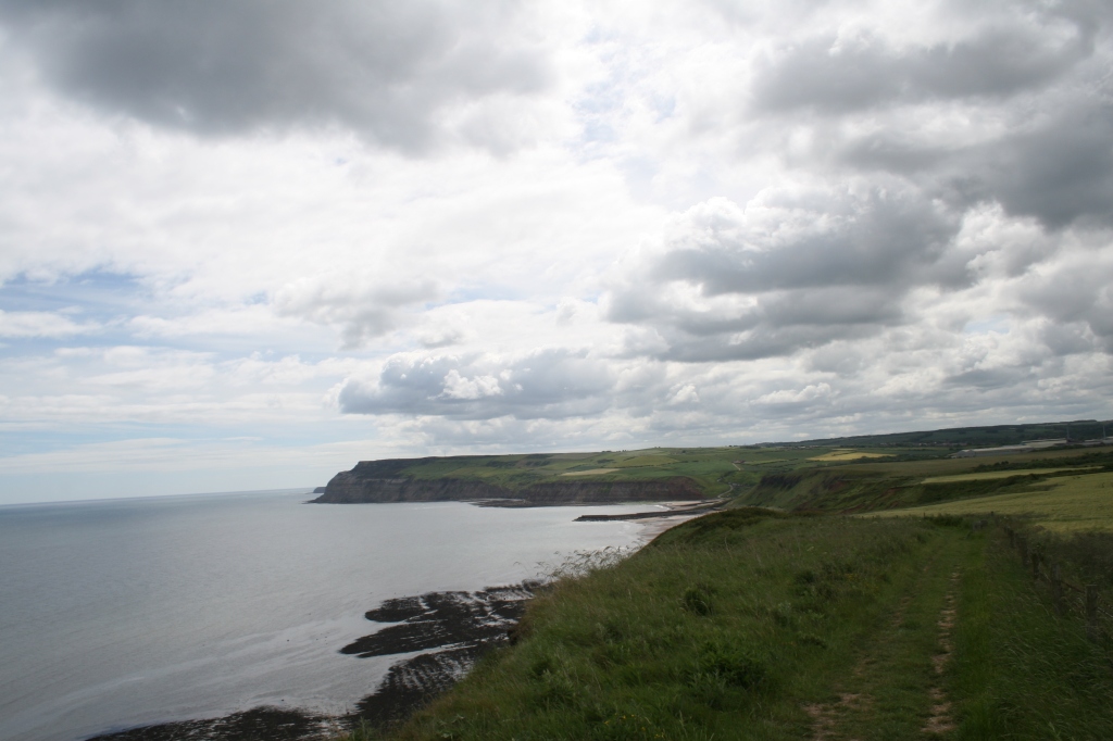
There’s a free car park right next to the sea in Skinningrove, so take your pick of the lovely beach (to the north) or walk along the cliffs to Staithes, which is what I did.
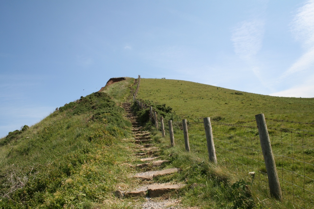
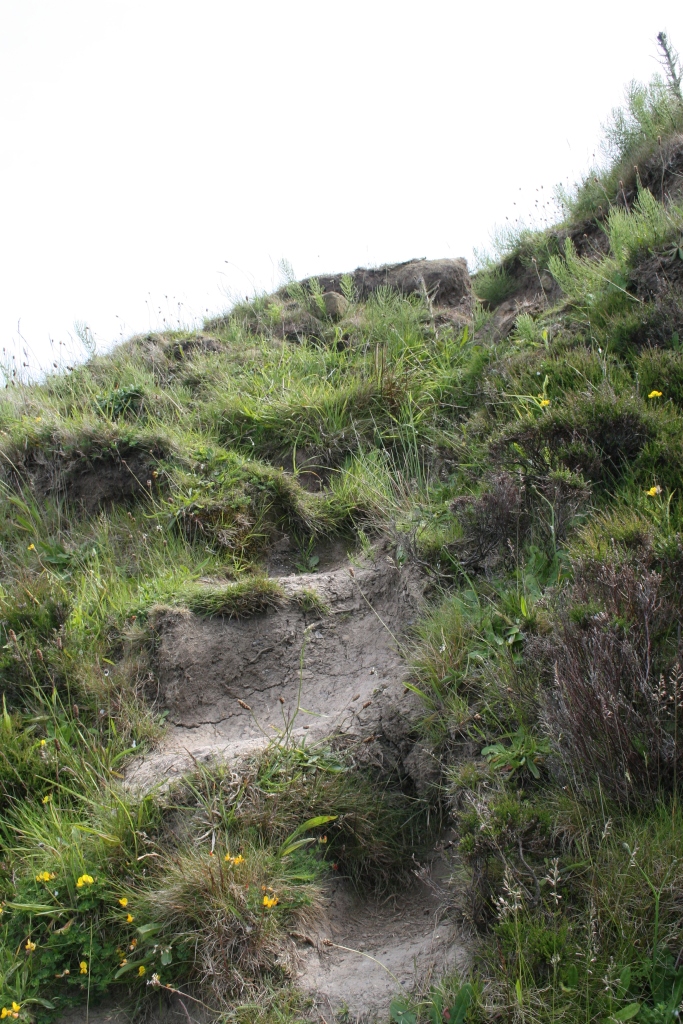
It’s up a steep set of steps but the view on the way up and at the top is more than worth it…
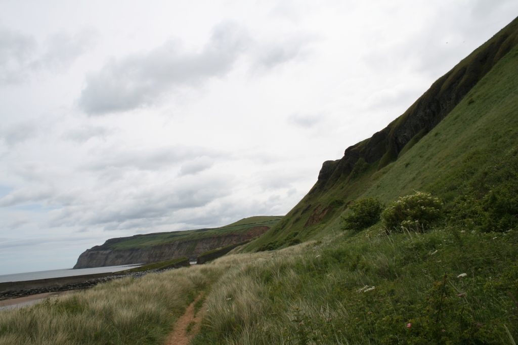
In the distance, there’s Hummersea House…
But first, it’s nice to make a new friend:
It turns out that Hummersea House has an interesting history linked to its inhabitants, the development of geology and the geology of the area in particular, which is rich in metals:
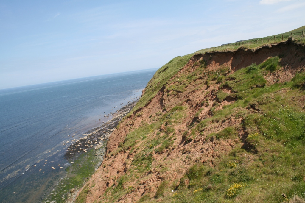
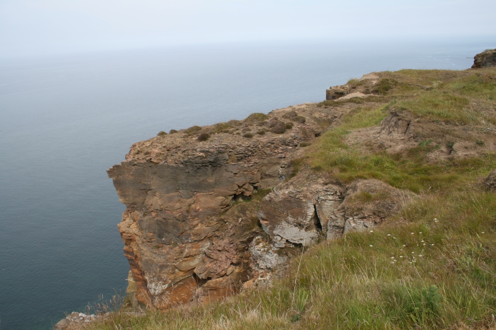
Besides that, the view is spectacular (if a bit steep)!
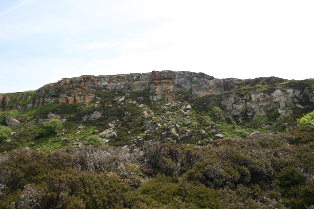
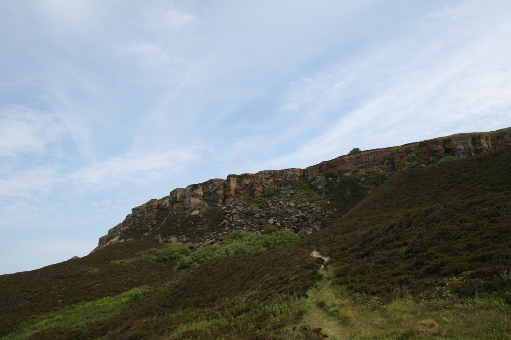
I spotted the sign for the Alum Quarries, now owned by National Trust, so I diverted off the Cleveland Way and into a blasted landscape.
It’s a very alien landscape and I half expected to see some monster out of ‘Doctor Who’ appear around the corner. But even here, a bleak and alien place, has examples of love:
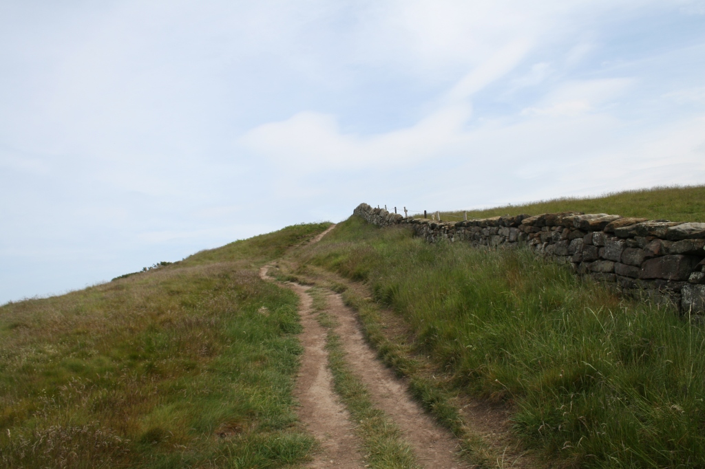
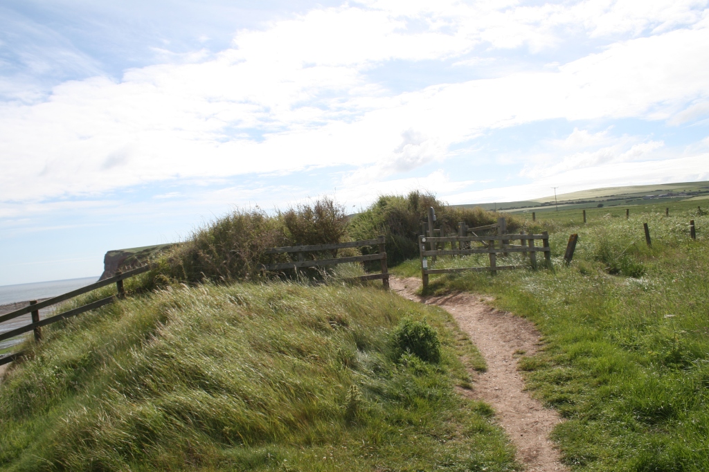
Then it’s a scramble to get back up to the Cleveland Way.
Back on to the cliff top…
A little further on, there’s a poem by ‘Ted’, written for his lost love:
Towards the end, there’s a tribute to the miners whose hard work has reshaped the landscape. Apparently some of the mines are still used for Dark Matter Research:
And another friend made… too quick for the camera!
I haven’t really done Staithes justice in the last few pictures. By that stage I admit to being ‘knackered’ but it’s a beautiful place which I will return to.
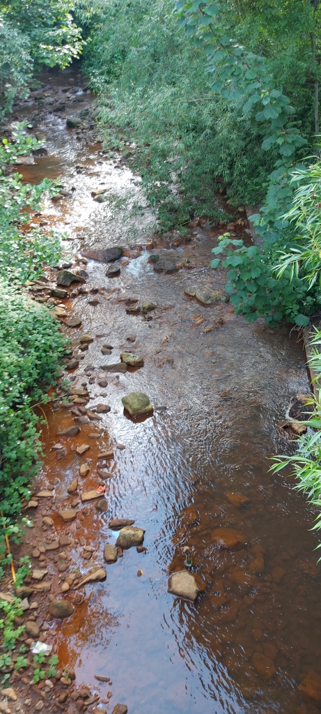
Then it was the bus back near to Skinningrove. You’ll notice how some of the streams run orange because of the mining of iron ore in the past:
Castleton is a village in Derbyshire and is part of the High Peak. It’s very busy tourist trap in the Spring and Summer and parking can be difficult. That’s why I set off very early from home and arrived at 6.30am for the walk.
I headed north from the village and uphill to The Great Ridge. It’s very steep and as you’ll see, can be a challenge to navigate in parts: rocky, muddy and sometimes with running water. Stout walking boots with good ankle support are recommended.
The ascent took me around 90 minutes including breaks and time to enjoy the scenery as I got higher. Don’t be afraid to plonk yourself down on a handy boulder for a breather – you’ll enjoy yourself much more.
There are a lot of sheep with lambs this time of year…
Plus a supremely disinterested cat:
Then it’s onwards and a lot of upwards:
A breather…
And some more upwards…
The view from the Great Ridge is worth the ascent, though.
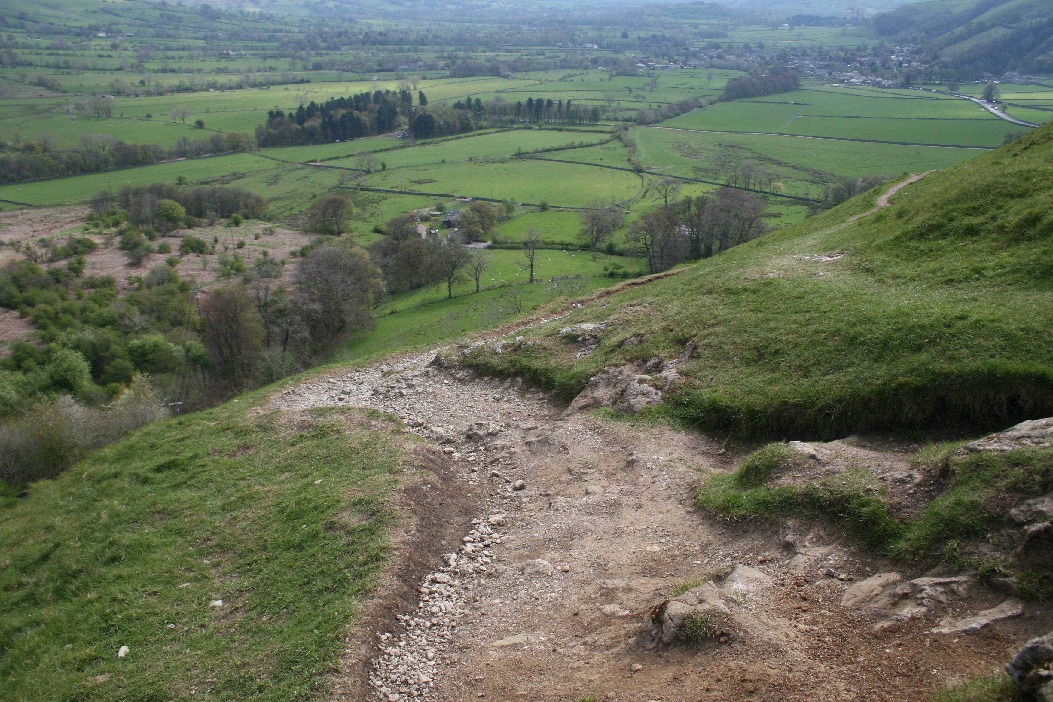
Then it’s off west to Mam Tor with some more upwards but this time with more gentle inclines.
The day began to brighten!
Then you’re at Mam Tor, the ‘mother hill’. The monument is at the site of a bronze age fort. It allows another great view of Castleton on one side and Edale on the other.
Then it’s all downhill:
Personally I found the entrance to the Blue John Cavern rather uninteresting and at £15 to get in, unlikely. I did enjoy a cup of tea while admiring Mam Tor. Shame about the camper van?
Downwards over the brow of the hill. The walk is a little rough with fine limestone and it’s easy to slip while enjoying the view.
A better view of Mam Tor. You can see where the hillside has repeatedly fallen away.
More sheep and lambs:
And a look at Winnat’s Pass while heading back to heading back to Castleton. It’s spectacular to drive though and the picture and video hardly does it justice. Some hang-gliders too!
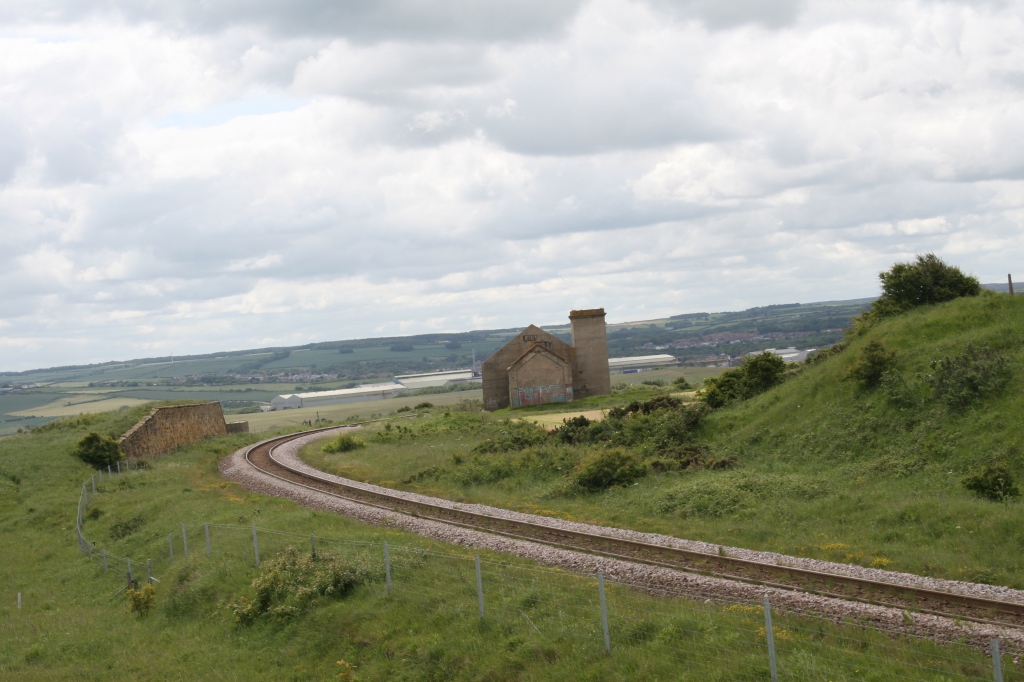
This is a trail using the remnants of the former Cromford and High Peak Railway which ran from Cromford Canal, south of Matlock, to Parsley Hey, where it meets the Tissington Trail heading north.
Although it looks bucolic, it’s actually a very industrialised landscape built for the Industrial Revolution and the transport of raw and finished goods. The whole area is pocked-marked by small ancient quarries and their huge modern equivalents.
It is a challenging walk at the beginning because of the inclines, some of them 1 in 8. For an unfit walker, it’s a gasp a minute!
The struggle upwards is worth it for the view…
Then onwards and upwards. I love the archway of the bridge over the trail.
Another lovely view…
And then back again to High Peak Junction…
The rock formations, blasted by explosives and hacked at by hand to create the train line are fascinating.
The first walk of 2022 with a friend. The pictures are all from my phone camera and not the trusty but antediluvian Canon 30D, so not as good quality.
Derwent Reservoir was formed by damming the river Derwent at the village of Derwent and was completed in 1916. The village is now underwater but apparently the ruins can be seen if there is an exceptionally dry summer.
You can walk around the whole reservoir – it’s around 6 miles but a bit ‘up and down’.
The Dam itself is very impressive!
These pictures and videos are @Aidan Parr 2022, so please ask permission if you want to use them. I’ll probably say ‘yes’!
A not madly exciting walk but sometimes it’s a sunny day in (nearly) Spring and you need to get out!
The Great Northern Greenway runs from the outskirts of Derby, through the former railways station (ruins) at Breadsall and onwards. the plan is to complete the walk, following the path of the Friargate Line to Ilkeston.
Here’s a link to the starting point. Park in the the nearby Meteor centre but be careful which bays you leave your car in. Some are limited to two hours, some require you to pay after that and some are free.
It’s relatively short but mostly even. It gets muddier and messier later, once you are directed off the old railway line, over the traffic roundabout and back on to the walk again. The official trail terminates at the junction with Lime Lane but you can walk further if you want to.
Over the roundabout and down into the muddy part…
These pictures and videos are @Aidan Parr 2021, so please ask permission if you want to use them. I’ll probably say ‘yes’!