I really enjoyed going to Spurn Point a couple of weeks ago. The post and pictures are here.
I didn’t get to walk much of it because of problems with my foot and I was unprepared for the walk! The herculean task awaited and I couldn’t resist the challenge. Seven hours and 8.5 miles later I got back to the car with sunburn, a sore back, knees and foot but happier than I’ve been in ages.
It’s a peculiar place. The further south you walk, the more lonely it feels. The washed away road lies in huge rafts of concrete scattered around like toys for giants. The remnants of Spurn Head’s history are also scattered about: the ruins of fortresses and the worn remains of anti-Tank blocks from the Second World War litter the beaches at low tide.
There’s eroded brickwork and mysterious concrete shapes everywhere.
Nearly everything made by human hand is in ruin leading to more impression of desolation, the exception being the RNLI station and housing for their staff. It leads to some reflection on the futility of battling the sea and how we tend to think we have mastery of nature.
On a more positive note, nature bursts forth everywhere and it is overwhelming Spurn Head’s history, good and bad.
Happily the walk back north on the beach on the eastern side was much more wild and empty. As you head north, though, there’s more remnants of man’s broken constructions.
That’s enough deep thought for now… thankfully!
There’s far too many pictures as the sky was beautiful and the coastal features were incredibly photogenic.
I’ve split the pictures:
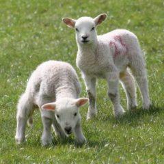
Birds:


Flowers:


Sea, sky and ruin:


Check the high tides as Spurn Head can be cut off at it’s narrowest point, a mere 50 metres wide. Do also look at the signs at the car park about safety if there is a high tide.
Go to the Yorkshire Wildlife Trust website for more information about the area and better photos…
I recommend the fry up in the cafe at the Spurn National Nature Reserve.
These pictures and videos are @Aidan Parr 2021, so please ask permission if you want to use them. I’ll probably say ‘yes’!


